(First posted 28th August, 2016)
A nostalgic look back at the 1977 JMB ‘A’ Level Geography Paper
“Le Creusot,” I enunciated excitedly in my best ‘O’ Level French accent as we sped past the road sign. “That’s one of the most important steel producing towns in the country.” The others in the car yawned.
Some hours later there was a sign to Montélimar. Neville and Gilbert started to sing George Harrison’s ‘Savoy Truffle’ but instead of joining in I said “Great! We’re getting near the André-Blondel hydro-electric scheme at Donzère-Mondragon. And we’ll soon be near the Marcoule nuclear power station.”
I had been like that all day. Neville and Gilbert must have been pretty fed up with the running commentary. We were driving down through France on our way to Provence and I was prattling like a poor Geography text book about the country’s electric power and industry. Having memorised most of the sketch maps in
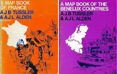
A Map Book of France by Tussler and Alden for ‘A’ level, I thought everyone ought to be fascinated by French economic activity.
Such is the power of knowledge. It gives you the means to bore everyone else to death in the mistaken belief you are being interesting.
Geography was the second subject I took at ‘A’ Level in my mid-twenties (the other was English Literature). It was going to be History but just as with English, the Woolsey Hall correspondence course started badly. The first half dozen pieces of work on Tudor and Stuart England came back from the tutor in Clacton-on-Sea graded from Very Good down to Weak without any clear indication why. Correspondence courses are not always a good idea, especially in subjects that benefit from face-to-face discussion.
But then, a couple of strokes of good luck. An old school friend, now a Geography teacher, suggested his subject would be more straightforward. He gave me a one-evening crash course and overview of the syllabus, and I decided to switch. Then, a friend of a friend lent me her impressively thorough notes from a few years earlier. They were full of splendid sketch maps and diagrams of river valleys and other landforms. She had got a grade A. You could almost fall in love with someone through the beauty of their ‘A’ Level Geography notes.
So I did Geography on my own, without a formal course, and got away with it. I bought copies of the syllabus and previous papers, analysed them carefully, pared everything down to what could be achieved in a year and planned my time meticulously. Just as in English Literature, the Geography syllabus offered an excessive amount of choice, which meant you could omit complete sections. Again, you were allowed to take away the question papers after the examinations, so here they are (click to enlarge). My son, who took ‘A’ Level Geography in more recent years, was surprised by the high quality of the supporting maps and photographic materials.
If you have trouble seeing full sized images of the papers, you can
download them in PDF form here.
GEOGRAPHY PAPER I (3 hours)
Section A: Geomorphology. On first sight it seems you had to answer one question from three, but as the second question was an either/or on different topics, it was effectively one from four.
There were questions on lakes, erosion in different climates, landforms and coasts. It looks like I went for Question 2(b) on landforms.
I enjoyed this part of the syllabus and covered more than necessary. I still pretend to be knowledgeable about such things when out in the countryside, and have kept my copy of the wonderful
Physical Geography by P. Lake.
Of the accompanying images, Photograph A was obviously the magnificent Flamborough Head which I know well. Please could someone enlighten me as to the location of Photograph B? Is it Orford Ness?
Section B: Meteorology, Soils and Vegetation. You had to answer just one question from these topics. In other words, you could omit two thirds of the syllabus here. I prepared the question on soils. Consequently I am still unable to distinguish stratus, cumulonimbus and other cloud formations.
Section C: Economic Geography. You were required to answer two questions from six.
Candidates still attending school would have carried out field studies covered by Questions 9 and 11(a), but not me. 1977 may have been the last year you could get away without doing a practical element.
I am no longer sure how many topics I did prepare, but it looks like my answers were on hydro-electric power, cotton and maritime fishing.
The street plan for Question 11(b), which I avoided, I can now identify as part of Bristol.
GEOGRAPHY PAPER II (3 hours)
Section A: map reading. One compulsory question.
The map covers an area to the south of Chatham in Kent.
Many faced map reading with trepidation but for me it was the part of the examination about which I felt most confident. Just like a driver with a few years’ experience, several years of country walking had made me certain I was an expert. It serves as a warning not to rely on confidence alone. Afterwards, I thought I had messed up this part so badly as to fall short of the grades I needed for university (BB or BC). I put in late Polytechnic applications and received offers of DE and EE. They turned out to be unnecessary.
Sections B and C: Europe (3 topics) and other parts of the world (7 topics).

Sections B and C cover ten topics in all, with a choice of six questions on each topic. You had to answer a total of three questions including at least one from each section. As there was nothing to stop you choosing two questions on the same topic, you could get away with preparing only two topics out of ten.
I thoroughly prepared B2 France and the Benelux countries (on which I answered two questions) and C6 the U.S.S.R.
Despite approaching it in a very strategic way, I liked this part of the syllabus too. It was great to find out more about the Charleroi area – the location of my foreign exchange trips while still at school (I had A Map Book of the Benelux Countries too). And in part C, I was captivated by the romantic and mysterious places of Asian Russia, such as Novosibirsk, Petropavlovsk and the Silk Road towns of Samarkand and Tashkent, then still little known behind the iron curtain.
Neville and Gilbert should have been thankful we were only spending a day driving South through France rather than a fortnight across the Soviet Union.
The full list of topics in Sections B and C was:
B1 West Germany, Norway and Sweden
B2 France, Belgium, Luxemburg and the Netherlands
B3 Italy Switzerland and Austria
C1 The U.S.A. and Canada
C2 Latin America (including the West Indies)
C3 Africa
C4 India, Pakistan, Bangladesh and Sri Lanka
C5 Australia, New Zealand, Malaysia, Indonesia and New Guinea
C6 The U.S.S.R.
C7 China and Japan
Dare I also mention that I got a grade A?


