links to: introduction and index - previous day - next day
Monday 29th August 1977
Another journal extract. Neville and I are now well into our guided walk, trekking in the south of Iceland with ten others. Today we move hut again, but by a roundabout route. Our walk goes from Skaelingar to the top of Gjátindur mountain (3,068 feet, 935m), then down through the Eldgjá canyon to Álftavötn (or Alftavatn). The canyon contains the 130 foot (40m) Ófærufoss waterfall. These features can be seen on the map. The huts are marked kofi (shelter).
The first thing we have to do is cross a river. Now this and one crossed yesterday are easy, but soon we come to a larger river which necessitates the rolled-up-trousers, bare-feet-in-boots technique to keep your socks dry. This causes me concern because my soft, canning factory, Wellington-boot steamed heels now carry sticking plaster which soon rubs unstuck when wet. I should have done more walking before coming, but there wasn’t time. My one practice day was not helpful because I wore new boots, so my heels had blisters before I came. I brought my older boots to Iceland, but the damage is done.
Ascending
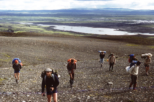
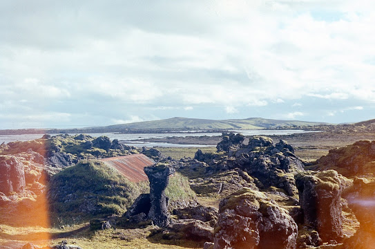
Gjátindur, we leave the rock pillars and green of Skaelingar behind, and crunch up through gravel to gain height. We see another group in the distance, the first we have
encountered so far. Paul, whose job it is to know who else is in the area,
says it is a party of Germans. Whilst we, hardened
rucksack-carrying explorers, have trekked overland on our own legs to get here,
it amuses us to hear they have travelled to within a few miles by bus.
Mockingly xenophobic remarks from nineteen-fifties war stories are heard, including the term
“schnitzel-eaters”. Paul then admits that Dick Phillips runs a similar
trip called the Walkers’ Motor Tour in which participants are able to
bring luxuries such as spare socks. This too is scoffed at, the ‘L’ becoming an ‘N’.
From Gjátindur we see distant views of ice
caps and volcanic cones, and below, the
extraordinary ‘fire canyon’ of Eldgjá, the largest volcanic canyon
in the world. Apparently, it just opened up several hundred years ago. It is nearly 900 feet deep (270m), between a quarter and half a
mile wide (600m) and 25 miles long (40km). Its first recorded eruption
in A.D. 939 is thought to have caused temperature drops of 2oC as far away as Central Asia.
The ash cloud made the summer of A.D. 940 the coolest in Europe for
1,500 years.
 |
| Eldgjá from Gjátindur |
“Eld” translates as “fire” and “gjá” as “canyon” – hence “fire canyon”. “Tindur” is “peaks, thus “Gjátindur” is “canyon peaks”. “Skaelingar” might mean “skeletons” which seems to make sense with the rock pillars. Google translates today’s destination, “Álftavötn” or “Alftavatn”, as “Swan Lakes”, which surely can’t be right, but “vötn” or “vatn” does mean water. We seem to be getting somewhere, except with “Sveinstindur”.
Four of us, oddly the four that went on our own road trip on Thursday, are having camera problems, evidenced by the blue lines on the pictures. When I try to rewind the film, it breaks inside the camera. Later, after dark, I open the case inside my sleeping bag, rewind the film by hand and manage to slot it back into the cartridge, but much of it is ruined. For pictures from the floor of the canyon, I again have to turn to the internet.
 |
| Gjátindur from Eldgjá |
We
descend the thousand-foot scree slope to the valley floor and begin to
walk its length. It is flat-bottomed with near-vertical sides, just like
a geomorphological diagram. After some time we reach the Ófærufoss
waterfall which flows in from the side in two steps. Above the lower
step the water has eroded a natural bridge around ten feet in diameter
and twenty feet long. We climb up to walk across [it collapsed in 1993].
Later
we stop beside a round mound around thirty feet high. Bridge School
Mike climbs up to look and discovers it is hollow. We all climb up to look.
Suddenly we turn down a dark, steep-sided
passageway between five and fifteen feet wide and thirty feet deep,
perhaps the course of an old river. It is a very strange volcanic
landscape.
Because of the indirect route taken, with its ascents and descents, today is the longest walk so far. By now we are
stringing out. Paul decides to wait near the top of a hill in a bitterly
cold wind for everyone to catch up. He tells us the Álftavötn hut is
visible from just over the top and that the front runners have gone on
ahead. I am walking quite slowly with blistered heels, but come across
Neville waiting about a hundred yards ahead of Paul.
“Watch it,
he’s ruthless. He doesn’t care if you go wrong,” Neville reminds me, but I decide to risk it and limp slowly on. About half an hour later I see Paul and the
others overtaking me high on a ridge to the right. What he has not told us is that
there is a river hidden in a gorge between where he had been waiting and
the hut, and that there is a natural bridge about a mile upstream. I
double back and eventually catch up with Debbie, Dennis and Ed the translator at the back just before
the hut. They are even slower than I am.
Meanwhile the bridge school “G.T. boys”, as Debbie and Dennis call them (do I detect slight hostility?), have had to wade the river. It is wide, deep, and fast-flowing, and they get wet. Moral – don’t go off in front. That’s the second time I’ve said that.
(next part)
Some names and personal details have been changed. I would be delighted to hear from anyone who was there.


