What we were supposed to be able to see was this:


The 8,000 foot (2,400m) Bunderchrinde Pass between Adelboden and Kandersteg was one of the highlights, but not as we expected. We should have been able to look back to the sunny Adelboden valley and its surrounding peaks, and ahead to the main chain of the Bernese Alps and mountains.
What we actually got was this; it was the 23rd August.

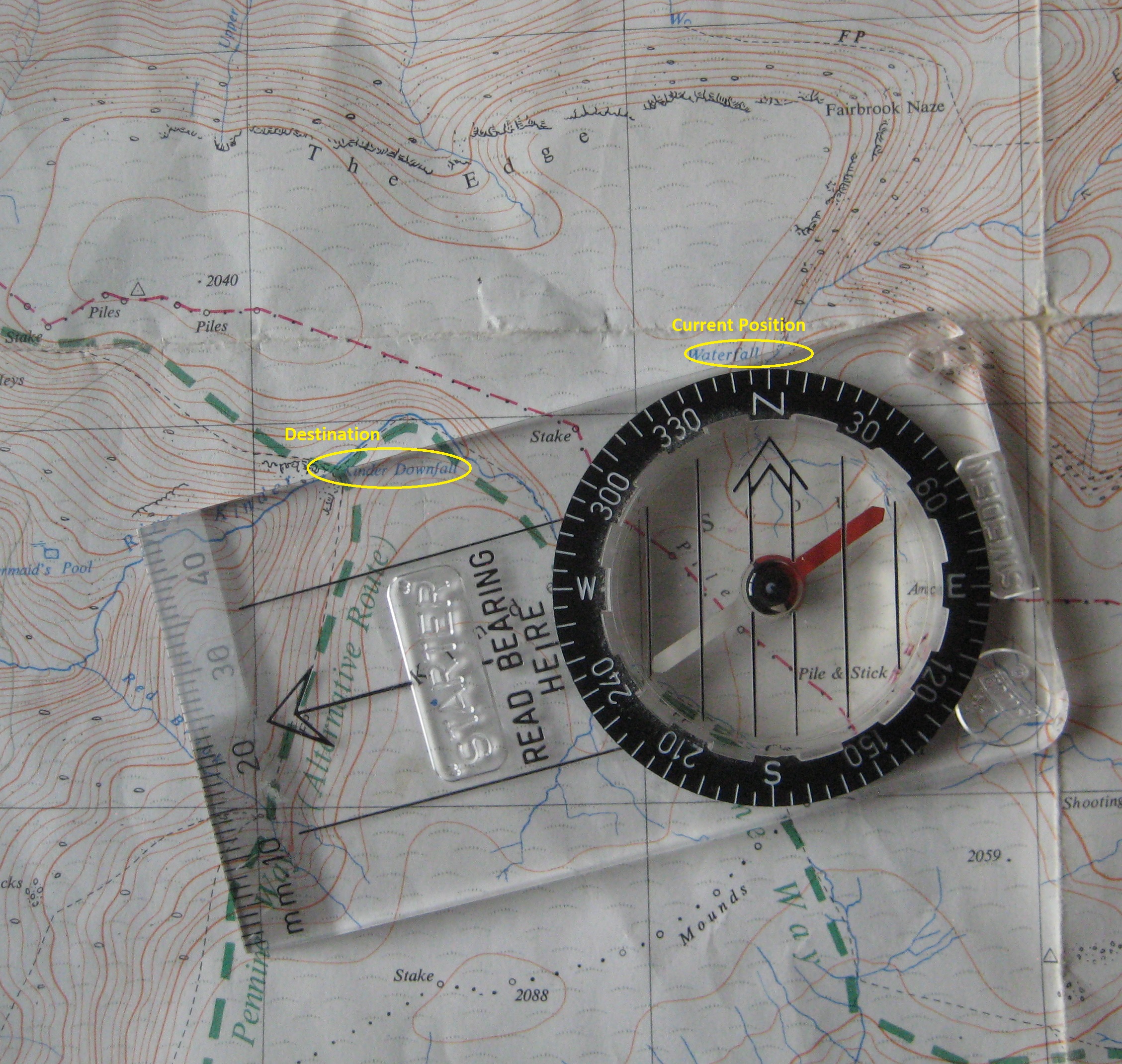
The idea was pretty audacious, arrogant even. Having backpacked across Rannoch Moor in Scotland, following a line on a map, carrying our tents and equipment, we thought we would do the same across the Swiss Alps. Five of us caught the train to Gstaad to walk the fifty or so miles to Grindelwald.
No one had heard of the Via Alpina then, or any other long distance trails; or at least we hadn’t. And except near the Eiger and Jungfrau, there were no signposts or footpaths as now. It was map and compass, following our own route. We had a real sense of adventure. I remember spending days poring over maps to work out start and end points accessible by train. There were no other walkers in the wilder parts. It would be very different now. Despite the awful weather, we think it was one of the best trips we did. We still talk about it.
We especially remember the humour. I could recount so many things: such as how we were plagued by the mountain pigs and cattle. We collected wood to build fires, but it did not keep them away. The pigs kept trying to get in the tent, and a cow ran off with Neville’s special private bad of Gold Blend instant coffee. He had to make to with Maxwell House like the rest of us. Dudule, who takes great delight in teasing Neville mercilessly, got the blame for years. He says that by now there must be a whole herd of Alpine cows that will eat only Gold Blend and nothing less. At Lenk, we escaped to an isolated hay loft for the night.
The weather for the first few days was not too bad, but then it changed. When we reached Adelboden, we spent a planned rest day on the mountain, and walked behind the ice. Gavin, later a vet, and Kev, about to become a geography and geology teacher, kept us informed about the plants, insects, and geology. As Neville waved his pipe in response, the stem flew off and fell into a crevasse. But he is nothing if not well organised, and had thought to bring spare bits. He had been smoking that same pipe for years. It had had four new bowls and three new stems, but it was still the same pipe he had been smoking for years.

Then the heavens opened. We sheltered from heavy rain all day behind a hut. My unusual capacity to do absolutely nothing for hours came in useful that day. Soaked through, we gave up and booked into a hostel, and dried out in front of a roaring fire. Kev was not happy that some cooked meat in his rucksack began to smell awful and turn green. It pervaded all else in there for several days.
We set off for Kandersteg over the Bunderchrinde pass. “For expert hikers only”, guides now say, but Kev, who is pretty good at mountaincraft, kept us safe. As we climbed it began to snow heavily, but we reasoned that snow is not as wet as rain. We reached Kandersteg and booked into another hostel for two nights. It is untrue that snow is not as wet as rain.


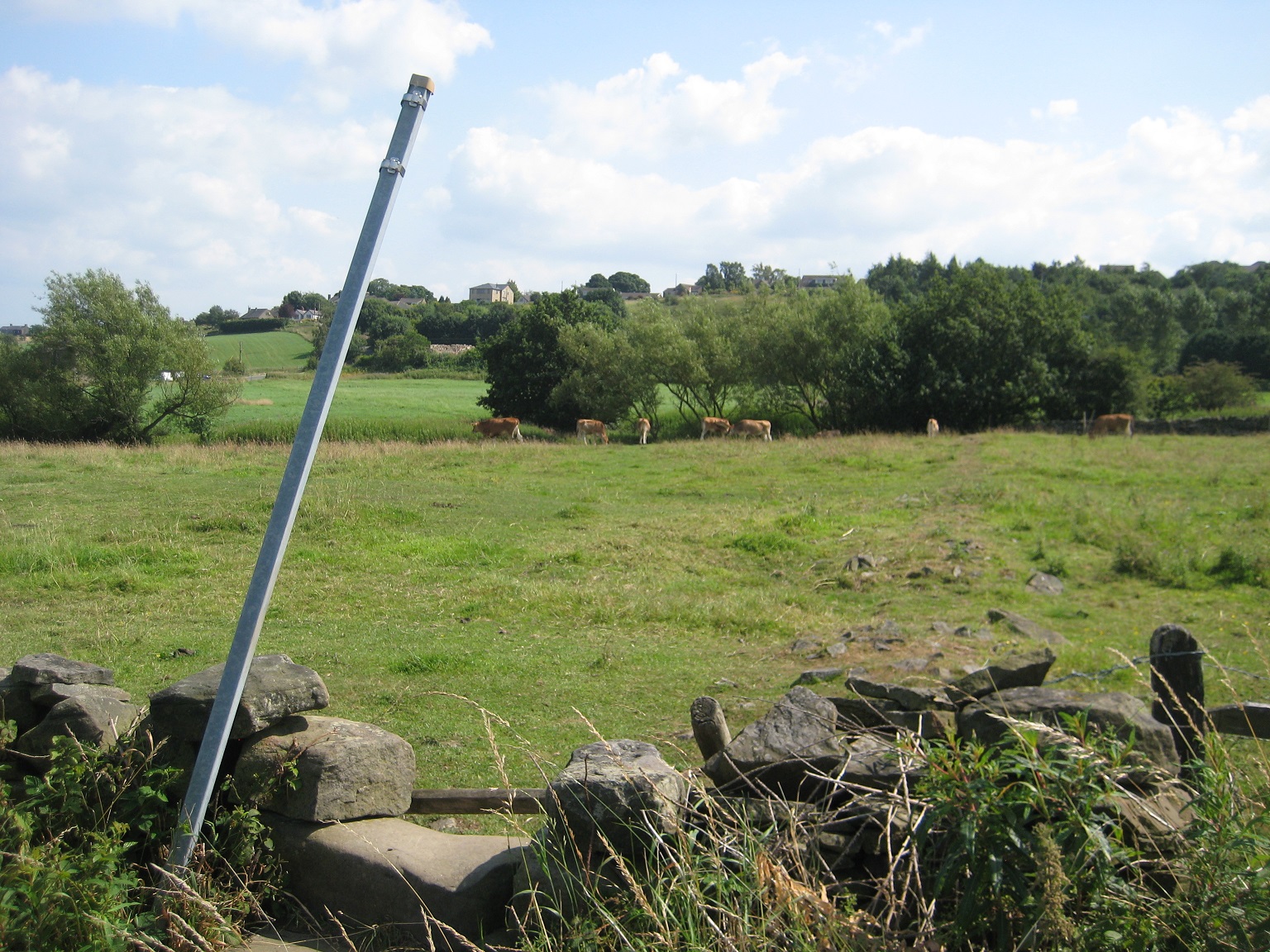
 |
| Kleine Scheideg: the man with the stick demonstrates how to move pigs, cows and Neville (just out of the picture). |
Hopelessly behind schedule, we took the train to Lauterbrunnen, walked up to Wengen, and camped. The Swiss mountain railways are incredible. After another train to Kleine Scheideg we made our way to the Eiger foothills where we camped again. I doubt you could put your tent anywhere you wanted now as we could then.

Like Chris Bonington, whose mountaineering books I soaked up, I have climbed on the North Face of the Eiger - well, the first 100 feet (30m) of it.


Our time up, we made our way to Grindelwald and a series of trains home. The train north along the French border was interminable, about ten hours, but I can still list most of the places where it stopped: Basel, Mulhouse, Metz, Lille, ...
Some more pictures:


.jpg "The Tower, Alport Castles")