A favourite Derbyshire walk through the years, possibly a metaphor for life
(first posted 13th January, 2018, 1550 words)
The bleak Kinder moorland can be incongruously beautiful on a fine day, but it was not like that on my first visit in 1974. It was dark and grim, covered in cloud, difficult to know where you were heading. As we ascended Fair Brook, veils of thick, grey mist closed around us, washing away the last of the autumn colours. Drizzle drifted down from the plateau, permeating our cagoules and soaking my canvas rucksack. It had been drenched so often it was beginning to smell like a bag of old socks. It could have been a metaphor for my life at the time: three jobs inside a year and a pointless, wasted term at teacher training college.
 |
| Seeking shelter: Fair Brook crags, 1974 |
Kinder is a silly place to be out in bad weather, but Neville and I
likened ourselves to hardened Himayalan mountaineers. I had even started to grow a beard
like Chris Bonington’s, a new self-image to get life and work back on track. The comparison was ridiculous, but role models and self-images can be helpful. There is nothing wrong in trying to find a bit of mental strength and inspiration, despite the obvious differences between the Himalayas and the Derbyshire Peak District, or for that matter, between a fearless expedition leader and an assistant accountant in an office.
We sheltered under overhanging rocks at the top of Fair Brook to eat our sandwiches. From there we took a rough bearing across the moor to Kinder Downfall: about 255 degrees. In more forgiving terrain, you would pick out a distant landmark and head towards it, re-checking your compass just now and again, but distant landmarks are few on Kinder Scout: there is only moor and sky if you’re lucky, and mist if you’re not. You can believe it the roof of the world where abominable bipeds dwell.
 |
| An abominable biped on Kinder Scout: spring 1975 |
The surface is broken into a maze of peat ridges, or ‘hags’, by deep, slippery trenches known as ‘groughs’, which twist and turn like waves in a sea of mud. Groughs can be fifteen feet deep (five metres), and there are a lot of them to cross.
 |
| Hags and groughs on Kinder plateau, 2005 |
Just as in life, you glide effortlessly along the tops of the hags until they veer off in the wrong direction or lead to a patch of impassable bog. You backtrack, looking for a place to cross, and descend into a grough, half-walking, half-sliding, only half in control, struggling to keep your balance and stay clean and dry. Inevitably you end up smeared in black peaty mud. You follow the grough until it narrows to a steep watery ‘V’ where, legs apart, one at each side, you struggle to continue. Or again, the grough turns in the wrong direction or leads into a pond. You look for a place to climb out and follow the tops of the hags again. Before long, you are laughing like a toddler stamping through muddy puddles in Wellington boots.
You check your direction constantly but cannot tell how far to the
left or right you have drifted. Soon you can be a hundred yards or
more off course. You might be enticed into following footprints, but
they can easily be from someone else who was helplessly lost, perhaps
one of those abominable bipeds. You might see other walkers and decide
to follow them, only to find they are wandering round in circles. You
really have to trust your compass, no matter how fallible. Providing you do, then sooner or
later you will come upon the River Kinder: not a river in the ordinary
sense, but a wider, flatter trench than the groughs, with a stony and
sometimes sandy floor. For most of the year you can walk westwards along
its bed until you arrive high above the sheer gritstone gorge of Kinder
Downfall.
 |
| The Kinder River: 1974 |
Kinder Downfall is the highest
waterfall in the Peak District, where the Kinder River tumbles a hundred feet (30 metres) from the
plateau. It is magnificent in spate, especially when the wind blows
it back upon itself in a shimmering rainbow cloud. At such times it would not be
unreasonable to call it Kinder Upfall.
 |
| Kinder Downfall (or should it be called Kinder Upfall?), 2005 |
We pressed on along the edge of the plateau – part of the Pennine Way – in our murky globe of gloom. We could just about make out the distinctive starfish shape of Kinder Reservoir below, but there were none of the distant views beyond Manchester to the mountains of Snowdonia you see in clear weather. We began to doubt our route. A couple of walkers came towards us, the only others we had seen all day. We asked whether we were on the right path for the Snake Inn. They looked doubtful.
“Probably, but it must be at least ten miles,” they thought.
That worried us. But that’s the thing about walking. It
is a metaphor for life. Whether you are slogging up a mountain, plodding endless distance or trailing others in wretched misery, you have to keep going through the grit and grimness. You have to get back on the hags and leave the groughs behind. Usually you do. In my case, it was the accountancy that got left behind. The Chris Bonington thing really did help, even though Bonington would never have been an accountant in the first place, or had his sandwiches made by his mum.
It turned out we were right and the other walkers wrong. Within half an hour we reached the corner of the plateau above Ashop Head, where a steep slope descends to a signpost at the junction of the Snake Path and Pennine Way. Within another half hour we were at the derelict Ashop Clough shooting cabin where we stopped for the last of our coffee, and for Neville to smoke his pipe and reflect upon the meaning of things.
 |
| The derelict shooting cabin in Ashop Clough: 1975 and 2011 |
Such as what did the shooting cabin mean? In 1974, it still sheltered you from the worst of the elements. You could just about visualise the cosy refuge it must have been for the privileged few before the “right to roam” trespass of 1932. The likes of us would not have been welcome then on the Kinder moors, I would have not been exploring different careers, and most of Bonington’s mountaineering pals would have been at work instead of climbing. The derelict structure was like a monument to social progress and freedom of opportunity.
Tellingly, it provides no shelter at all now. During the last forty years or so, the east gable end, the fireplace and roof have disappeared without trace. The only slight improvement is to the bridge across the stream to Black Ashop Moor, which is now marginally sturdier than the precarious plank you once dared cross at your peril. Fortunately, you never had to. The route continues on the northern side of the stream and soon passes through woods to steps back up to the road.
 |
| Looking along Seal Edge towards Fairbrook Naze on the far right |
Since then, I have wandered this northern part of Kinder Scout at least a dozen more times, in every kind of weather. One summer day, when the sun was shining and the ferns and heather at their loveliest, I took my son and daughter, she was then only seven, across the bottom of Fair Brook and up to Seal Edge, forgetting just how far it is to return down the Fair Brook valley, but she did it without complaint. Another day, alone on the same route, I surprised two wild wallabies at the western end of Seal Edge, although not as much as they surprised me. They jumped out and disappeared across the moor before I could get my camera, leaving me wondering whether I had simply imagined them.
 |
| Icicles on the Snake Path through Ashop Clough: winter 1976 |
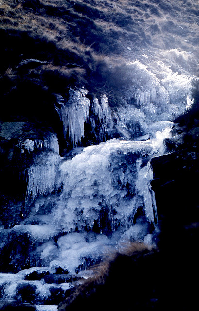
I have been on the Snake Path when the Ashop was frozen hard and long icicles lined the banks like crystal chandeliers. I have walked east along The Edge aiming for the top of Fair Brook and completely failed to recognise it (not alone I should add), and had to hitch a lift back to the car after finally descending to the road. That’s what happens on Kinder Scout when you arrogantly think you know it well enough not to look at your map and compass. I once tried to cross the top of Kinder from the Downfall to Fair Brook, which requires more accurate compass use than east to west, and after what seemed like an eternity, emerged way off course near Fairbook Naze looking over The Edge. Not accurate enough! When I eventually reached Fair Brook that day, the descent just about finished my knees. Lessons, lessons, lessons, but things turn out right in the end.
I suppose now, with satnav, you know exactly where you are all the time, but I’m not having one of those. It’s cheating. I don’t want to make things too easy for myself. It doesn’t fit my self-image, even though, unlike Sir Chris Bonington, I won’t be shimmying up The Old Man of Hoy at the age of eighty.
 |
| Fair Brook with Kinder Scout in mist in 1974, and clear in 2007 |


